Trinity Tactical German Unmanned Aerial Vehicle (UAV)
Trinity Tactical
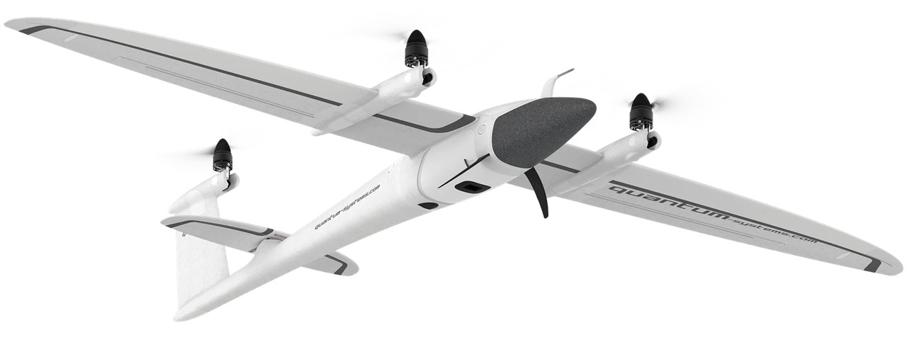
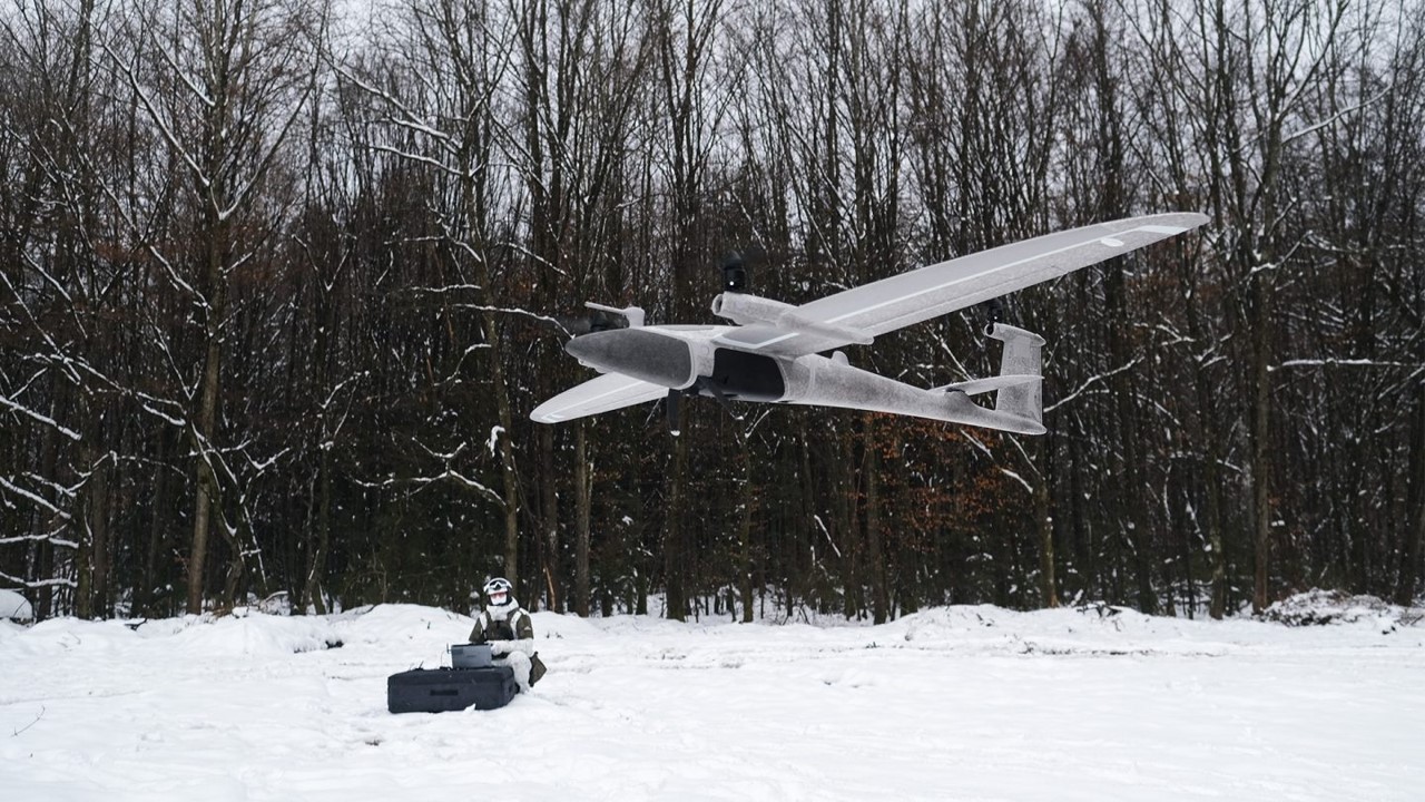
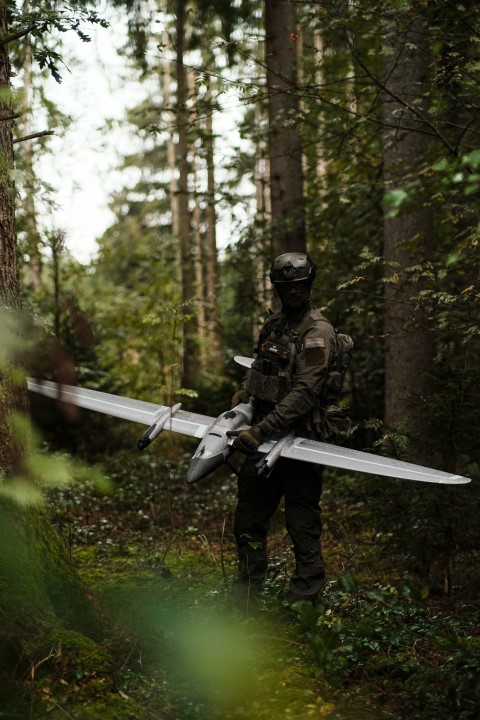
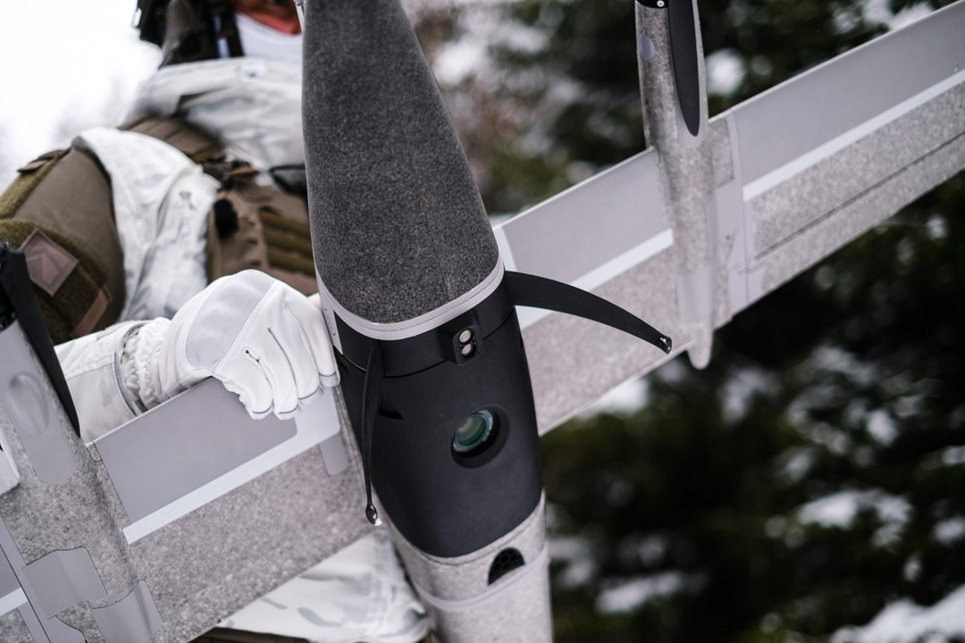
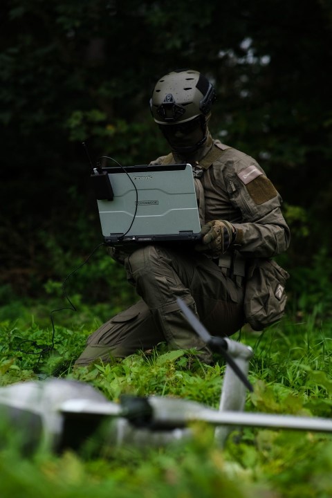
The Trinity Tactical German Unmanned Aerial Vehicle (UAV) utilizes advanced commercial eVTOL technology from the Trinity F90+ UAS, providing users with a durable and portable system that can be easily carried in a rucksack. It complies with current cybersecurity and NDAA requirements. Tactical teams operating in forward-deployed, disconnected environments require immediate access to imagery, rather than relying on information from rear-echelon sources. Trinity Tactical enables the creation of a Geographic Information System (GIS) at the tactical edge. This UAV can perform fully controlled vertical take-offs and landings, even in confined spaces. Boasting an IP54 rating and an ESC cooling system, the Trinity Tactical can operate efficiently for up to 90 minutes in various environmental conditions and achieve a maximum speed of 17 meters per second. In a single flight, it can cover an area of 700 hectares or a 90-kilometre-long linear corridor, achieving an extremely accurate ground sampling distance (GSD) resolution of up to one centimeter. The system features a range of interchangeable sensors, including high-resolution RGB and multi-spectral cameras, as well as a LiDAR scanner. These sensors are seamlessly integrated and can be swapped in seconds using a clever quick-lock mechanism. This versatility makes the Trinity Tactical ideal for data capture in tasks such as route planning, battle management assessment, line-of-sight analytics, landing zone reconnaissance, and other intelligence collection activities. Trinity Tactical is compactly stored and carried in a backpack and can be made operational in just minutes. Its modular design allows for quick assembly and payload exchange without the need for tools. The system is equipped with QBase 3D flight and mission planning software, enabling automated tactical mapping and terrain visualization to lessen the cognitive load on the operator. With a flight time of 90 minutes, Trinity Tactical can efficiently cover large areas of 700 hectares in a single flight. Onboard geotagging, direct georeferencing, and preliminary image stitching streamline the data capture and processing workload for the operator.